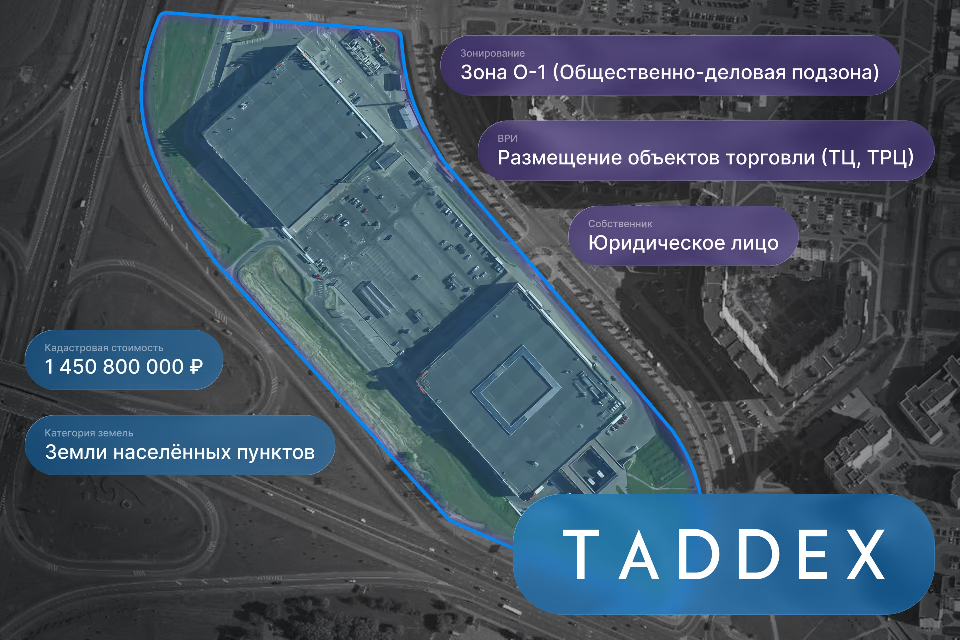

The project was centered on developing a digital platform for the automated verification of land plots by cadastral number. The goal was to create more than just a report-generation service; it required a comprehensive information system that integrates data collection from external sources, information processing, analytical tools, AI technologies, and various user scenarios into a single product.
Development of an automated land plot analysis platform
The first stage involved developing the information system architecture and the platform's server-side environment. The BPA team designed the backend logic that manages the entire verification lifecycle of a plot: from the initial request to the generation of the final report.
We implemented the server-side of the application, including user request processing, task queue management, result storage, report generation status tracking, and interaction mechanisms with third-party services. Special attention was paid to the platform's stability under high concurrent request volumes and the ability to scale the product in the future.
Beyond the technical components, we implemented mechanisms for commercial operation, including management of pricing plans, verification limits, user accounts, payment scenarios, and a subscription-based access model. This transformed the platform into a standalone commercial digital product.
Integration with external data sources and government services
One of the most labor-intensive stages of the project was integrating with external data sources. To provide a complete picture of a land plot, the service needed to retrieve information from various information systems containing cadastral data, property rights, restrictions, territorial zoning, and real estate characteristics.
The project involved processing data from external sources, implementing mechanisms for retrieving information via API, and developing a unified data normalization layer. This allowed for the automatic consolidation of information from multiple systems, bringing it into a standardized structure for subsequent analysis.
Development of an analytical reporting system
Once a unified data set was established, we implemented an analytical reporting system. The primary challenge was to transform a large volume of disparate but essential information into an intuitive decision-making tool.
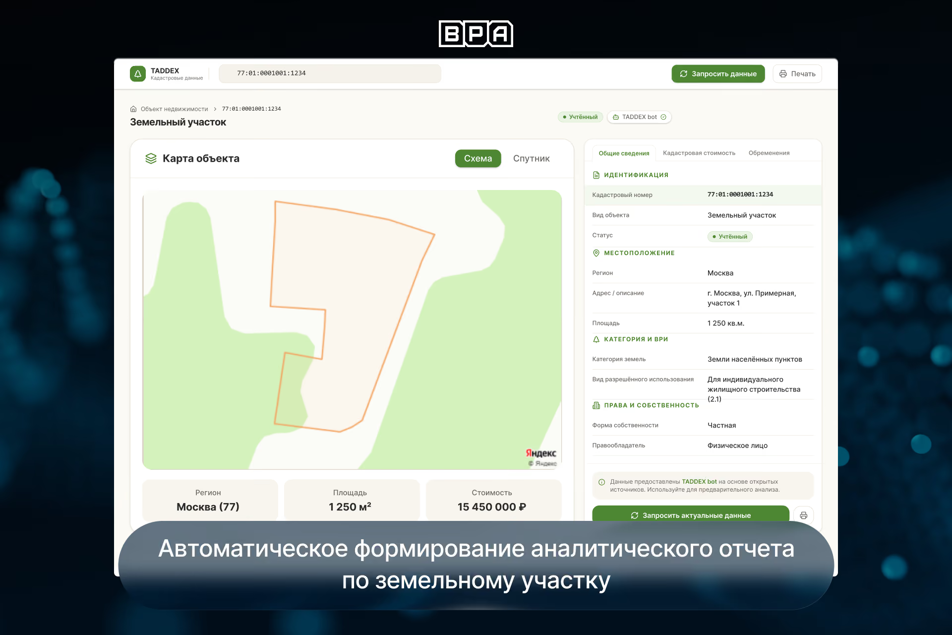
The team developed an analytical report structure that combines information about the property, ownership rights, land-use restrictions, urban planning parameters, neighboring objects, and other factors that could influence the value and development potential of the plot.
As a result, users receive a single analytical conclusion regarding the property rather than a collection of raw exports from various services.
AI module for intelligent real estate analysis
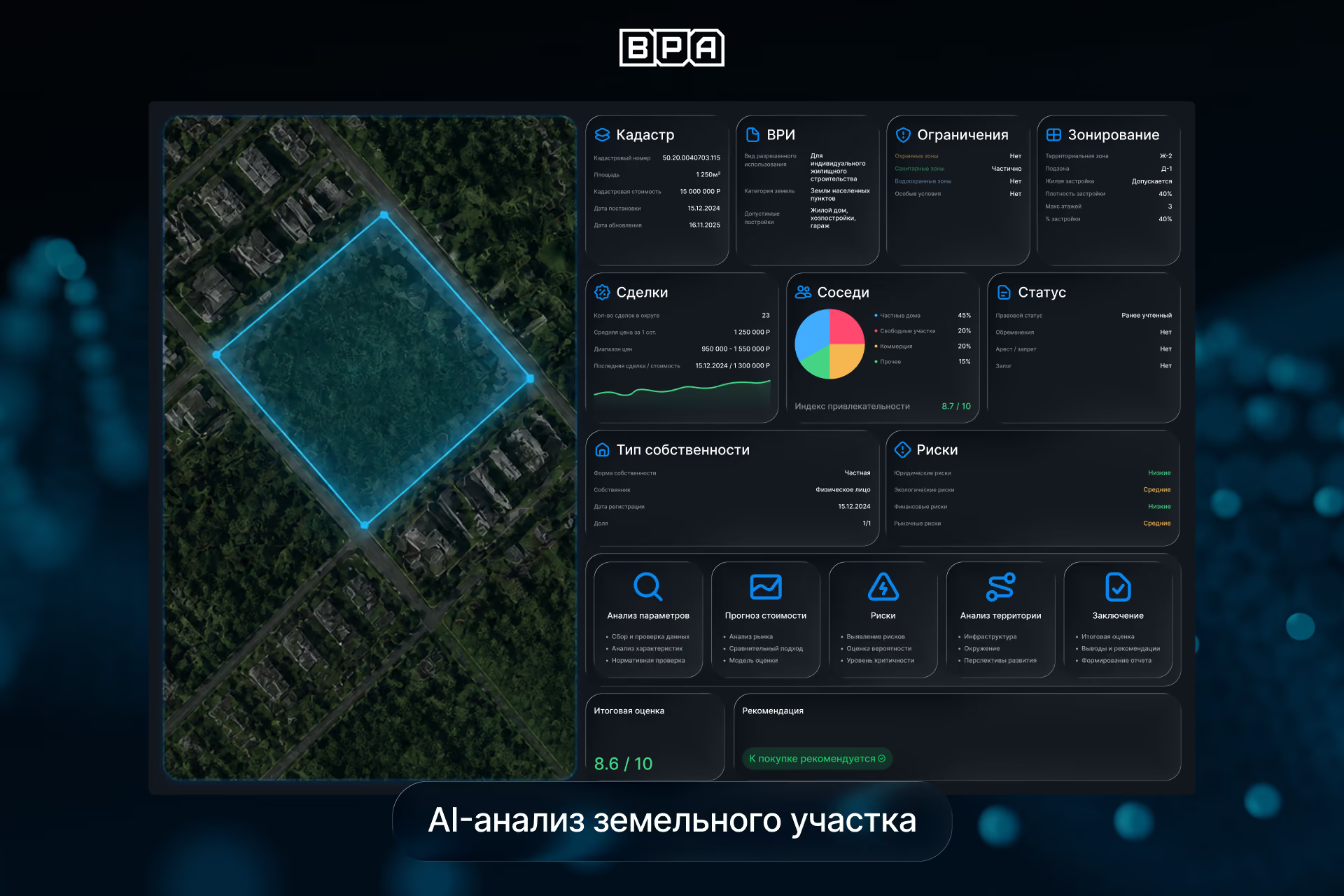
A key area of the platform's development is an AI module designed to supplement traditional real estate verification with intelligent analytics. The service architecture allows for the use of machine learning methods for predictive analysis of land plots, including evaluating object characteristics, surrounding area parameters, and market data.
In the future, this module can be used to generate valuation insights, identify factors affecting the value of a land asset, and determine potential risks. The platform can also incorporate generative analytics to transform structured data into clear, actionable text-based conclusions and recommendations for the user.
API development for enterprise clients
For high-volume users and corporate clients, we implemented a dedicated API that allows for the integration of the platform's capabilities directly into their own information systems.
This enables the automatic initiation of land plot checks, retrieval of analysis results, report generation, and the use of TADDEX data within internal business processes without manual intervention.
We implemented batch processing for corporate clients, allowing multiple reports to be generated in a single operation. This scenario is essential for analyzing land asset portfolios, investment projects, and large-scale real estate transactions.
This approach is particularly valuable for developers, investment firms, legal consultants, and organizations managing large numbers of land assets.
User experience and interface design
Our team developed user scenarios and platform interfaces tailored to several user categories: private real estate buyers, investors, developers, legal consultants, and corporate clients. Each category has its own specific interaction workflows within the service.
Special attention was paid to minimizing the number of steps required to achieve a result. We designed workflows for ordering reports, tracking check history, managing user accounts, handling notifications, processing payments, and navigating the service.
During the UX design phase, we carefully planned the screen structure, navigation logic, and visual hierarchy. This ensures the platform is intuitive even for users without specialized knowledge in cadastral records, real estate, or land law.
To increase accessibility, we implemented a Telegram bot that allows users to initiate land checks, monitor report status, and receive results without needing to use the web interface.

Change monitoring and product development
Beyond one-time property checks, the platform includes a feature for monitoring changes to real estate objects. Users can track specific land plots and receive notifications whenever significant parameters change.
The solution was designed from the ground up as a scalable digital platform. As a result, the client received not just a real estate verification tool, but a foundation for future growth, including the ability to connect new data sources, expand analytical capabilities, and integrate additional AI modules.