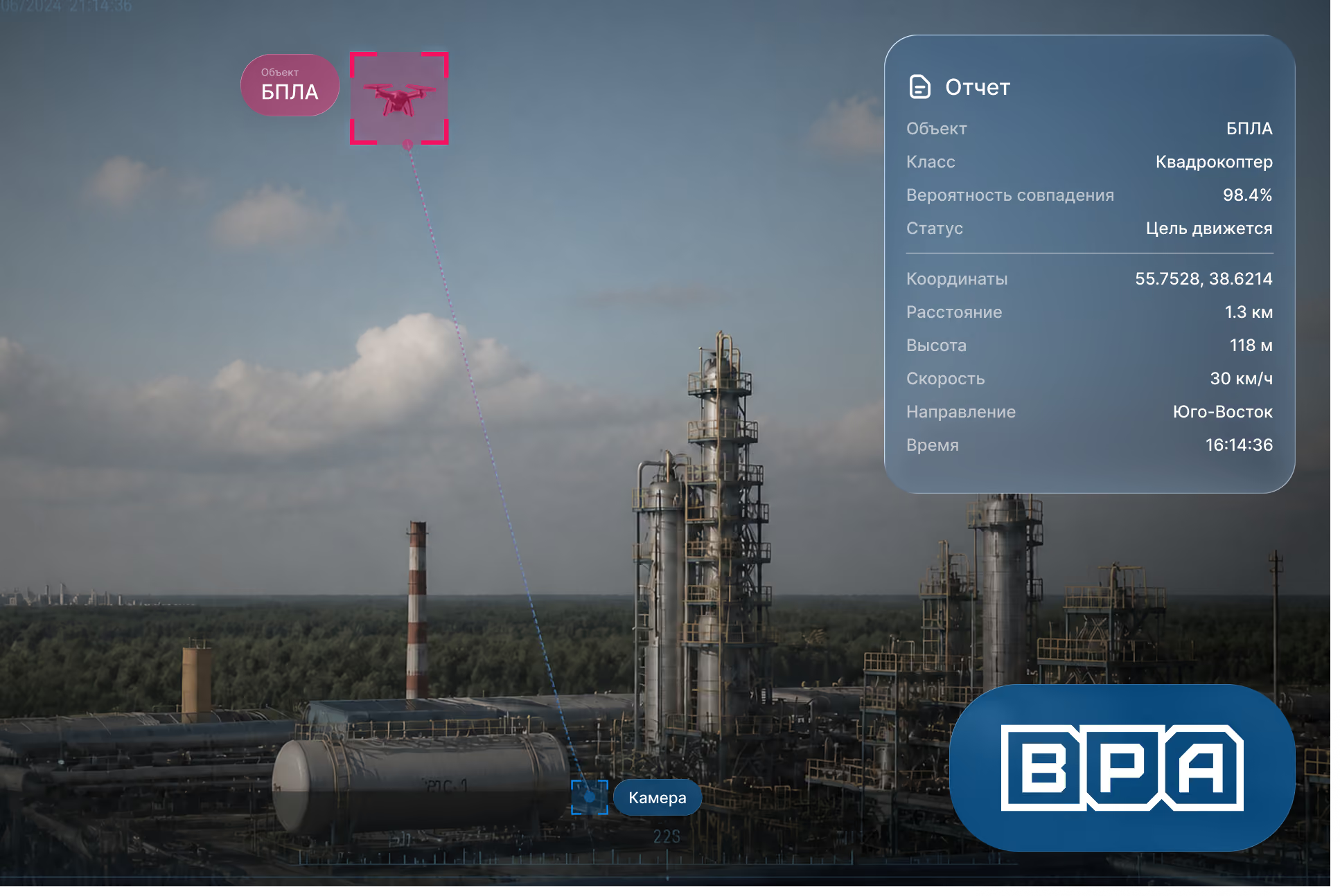

Computer vision-based UAV detection system
The solution is based on a two-stage architecture for automatic airspace monitoring. The complex was designed for 24/7 detection of small aerial targets, including drones and fixed-wing UAVs, as well as their tracking and subsequent classification.
To address this challenge, industrial video analytics based on computer vision were used, capable of analyzing video streams under complex conditions.
The solution architecture combines wide-angle cameras, PTZ cameras with optical zoom, thermal imaging modules, a local computing server, and an operator software interface. This approach allows for initial target acquisition over a large surveillance area and automatic switching to detailed object tracking once a target is detected.
To ensure the complex operates effectively under various conditions, separate image processing algorithms were developed for both daylight and thermal spectra.
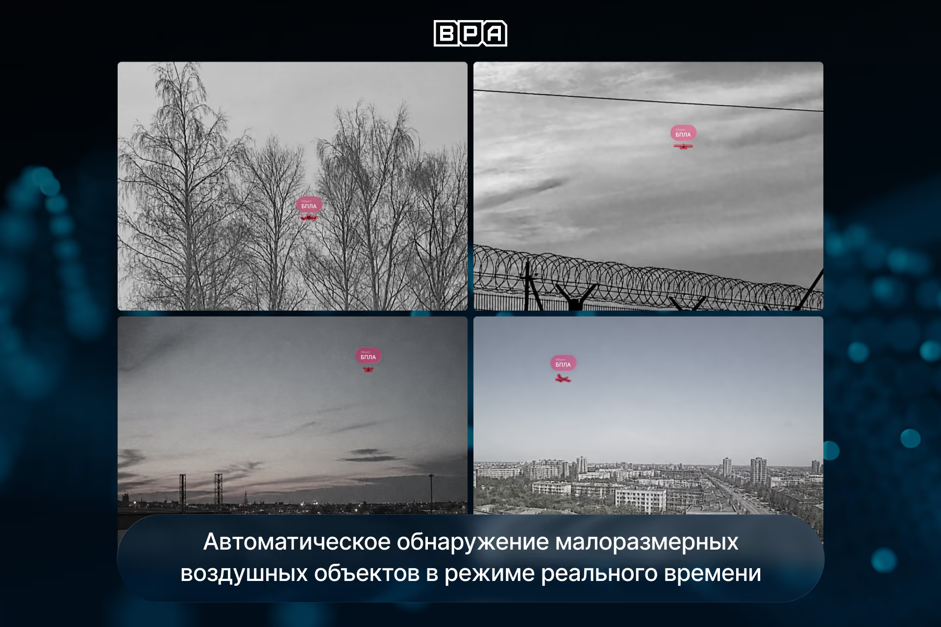
Preparation and training of artificial intelligence models
One of the most labor-intensive stages of the project was creating the training dataset for the computer vision models.
More than 200,000 images of aerial objects were collected for training and testing the algorithms, captured across various geographic locations, weather conditions, and operational scenarios. The dataset included materials with varying levels of lighting, cloud cover, glare, backlighting, complex backgrounds, and different viewing angles.
Special attention was paid to preparing data for small objects, which may occupy only a few dozen pixels in an image.
As part of the project, specialized AI algorithms were developed for drones and other aerial objects, capable of working with both visible-range video streams and thermal data. This ensured the stable operation of the complex both day and night.
Aerial target detection
The first circuit of the system is responsible for continuous airspace monitoring.
Algorithms analyze the video feed from wide-angle cameras in real time to search for moving objects in the sky. Once a potential target is detected, the system automatically determines its coordinates, direction of movement, and tracking parameters.
To improve detection reliability, mechanisms were implemented to filter out noise, false positives, and unstable detections caused by clouds, glare, precipitation, and other environmental factors.
Intelligent target tracking
Once an object is initially detected, the system automatically transmits its coordinates to a PTZ camera with optical zoom.
Control algorithms automatically aim the camera at the target, adjust its position as the object moves, and ensure continuous tracking within the frame.
Thanks to this automation, the operator does not need to manually search for objects or control the PTZ device. The system independently keeps the target in the field of view and provides a zoomed-in image for further analysis.
Aerial object classification
After a detailed image is captured, a second AI loop is triggered: the aerial object classification module.
Its purpose is to identify the type of detected target and reduce the number of false alarms.
The algorithms have been trained to distinguish between:
- quadcopters and drones;
- fixed-wing UAVs;
- helicopters;
- airplanes;
- birds.
To improve classification accuracy, the system uses both visual object features and additional analysis of the object's behavior in the airspace.
Flight path analysis
One of the key features of the project is the use of flight path analysis algorithms.
In addition to the object's image, the system analyzes its movement history between frames, direction of travel, speed variations, and maneuvering patterns.
This approach allows the system to account for behavioral characteristics. For example, birds and drones may look similar at long distances, but they differ significantly in their movement patterns. Combining visual classification with trajectory analysis has significantly increased the reliability of aerial target recognition.
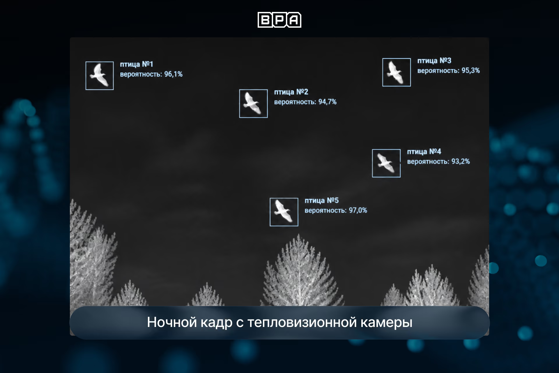
Monitoring interface and event management
A video analytics platform with a web-based interface for monitoring airspace was developed for operators.
The system displays:
- detected objects;
- target type;
- detection coordinates;
- tracking history;
- event archive;
- alarm log.
The interface provides centralized airspace control and gives the operator all the information necessary for rapid response.